
King Rehoboam: Mapping the Kingdom of Judah
King Rehoboam, son of Solomon and grandson of David, ruled the southern Kingdom of Judah during the early 10th century BCE. His reign marked a major change in the political geography of ancient Israel: the united kingdom established by David was divided, with the northern tribes forming the Kingdom of Israel while Rehoboam retained Judah and Benjamin, with Jerusalem as his capital.
Rehoboam's reign can be understood fundamentally through its geography. From the political assembly at Shechem to the fortified cities of Judah, and from Jerusalem to the Egyptian campaign of Pharaoh Shishak, the biblical and archaeological records describe a kingdom adapting its borders and defenses following the loss of the northern territories.
The topographical landscape of the Judean Hills and the Shephelah provides a physical framework for understanding this defining period.
Shechem: Where the United Kingdom Divided
Rehoboam's reign began at Shechem, an ancient city in the central hill country of the Shomron (Samaria), traditionally identified with Tel Balata.
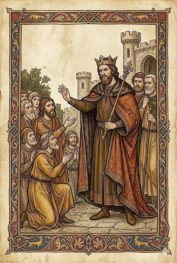
According to 1 Kings 12 and 2 Chronicles 10, the tribes of Israel assembled at Shechem to coronate Rehoboam. Jeroboam, son of Nebat, represented the northern tribes, petitioning Rehoboam to reduce the taxation and labor burdens imposed during Solomon's reign. Rehoboam rejected the advice of his elders and answered that he would make the burden heavier.
The northern tribes responded by breaking with the house of David:
> “What share do we have in David? We have no inheritance in the son of Jesse!” (1 Kings 12:16)
The political division followed. Jeroboam became ruler of the northern tribes, while Rehoboam retained the territories centered on Judah and Benjamin.
Geographically, the choice of Shechem for Rehoboam's accession is significant. Sitting squarely in the central hill country, it had long-standing political and religious associations. Placing the succession crisis at this major northern center ultimately cemented the new border between the two kingdoms.
Jerusalem: Capital of the Judean Kingdom
The schism fundamentally changed Jerusalem's political position. Under David and Solomon, Jerusalem served as the capital of the united monarchy. After the division, it transitioned into the fortress-capital of the smaller Kingdom of Judah, remaining the seat of the Davidic dynasty.
Crucially, the city retained the First Temple built by Solomon. Jerusalem therefore remained the political and religious center of the southern kingdom. The biblical account records that priests and Levites from the northern territories migrated south to Judah and Jerusalem after Jeroboam established competing religious centers in Dan and Beit El, strengthening the demographic and administrative core of Judah.
## Rehoboam's Fortified Cities
Facing exposed borders, the biblical account describes Rehoboam strengthening the defenses of Judah. 2 Chronicles 11:5–12 lists 15 fortified cities:
* Bethlehem, Etam, Tekoa
* Beth-zur, Socoh, Adullam
* Gath, Mareshah, Ziph
* Adoraim, Lachish, Azekah
* Zorah, Aijalon, Hebron
The text notes that Rehoboam "built cities for defense in Judah," fortifying the strongholds, appointing commanders, and storing provisions, oil, and wine in them. This creates a clear geographic picture of a kingdom establishing a defense perimeter extending from the approaches of Jerusalem, through the Judean Hills, and westward into the Shephelah.
(Note on Archaeological Context: While the biblical text attributes this specific network to Rehoboam, archaeologists such as Nadav Na'aman have suggested that the geographic arrangement of these cities may also align with Judah's later preparations against Assyria under King Hezekiah. Regardless of the exact chronology of individual stones, the list preserves a highly accurate record of the strategic military geography of early Judah.)
The Judean Hills: Protecting the Southern Approaches
Several cities in this defensive network occupied strategic elevations in the Judean highlands.
* Tekoa, south of Jerusalem, guarded the immediate southern approaches to the capital.
* Hebron, farther south in the Judean Hills, had previously served as David's royal city before the capital moved to Jerusalem.
* Beth-zur, Ziph, and Adoraim extended the network deep into the southern Judean landscape.
This settlement pattern demonstrates a coordinated attempt to control the principal ridge routes traversing the hill country.
The Shephelah: The Western Approach
The western edge of Judah was critical to its survival. The Shephelah—the low foothills between the Judean mountains and the Mediterranean coastal plain—contained the valley routes through which invading armies would move toward the highlands.
Several key cities in the biblical list guarded this transition zone, including Azekah, Socoh, Adullam, Mareshah, and Lachish. Socoh, for example, overlooked the Valley of Elah between Adullam and Azekah. Control of the Shephelah was central to preventing coastal powers from penetrating the Judean heartland.
Aijalon and the Northern Approach
Aijalon occupied another strategically vital position. The Aijalon Valley provided direct access between the coastal plain and the central highlands. Following the division of the kingdom, Aijalon remained within Judah and was fortified to block northern and western incursions toward Jerusalem.
Pharaoh Shishak and the Egyptian Campaign
Judah's defenses were tested in Rehoboam's fifth year by an Egyptian campaign. Modern historians identify the biblical King Shishak with Shoshenq I, founder of Egypt's 22nd Dynasty.
According to 2 Chronicles 12, Shishak captured the fortified cities of Judah and advanced on Jerusalem. Rehoboam surrendered the treasures of the Temple and the royal palace to prevent the city's destruction, placing Jerusalem at the endpoint of a campaign that swept through the newly fortified Judean territory.
The Karnak Record of Shoshenq I
Egyptian archaeology provides a vital external source for this era. At Karnak, the Bubastite Portal features a topographical relief commissioned by Shoshenq I detailing his campaign in the Levant.
The Karnak list independently documents an Egyptian military campaign through the region during the period associated with Rehoboam. While the exact correlation between the Egyptian itinerary and the biblical account remains a subject of ongoing scholarly analysis, the external evidence confirms a major geopolitical upheaval that necessitated the defensive consolidation of the Judean highlands.
The Geographic Legacy of Rehoboam
Rehoboam's reign permanently altered the map of the ancient Levant. The decisions and infrastructure projects of his era established the physical boundaries of the Kingdom of Judah.
The historical continuity of his reign can still be traced across the landscape today:
* Shechem marks the geographic site of the political schism.
* Jerusalem consolidated its role as the eternal capital of the Davidic dynasty.
* Hebron and Tekoa anchored the Judean highlands.
* Azekah, Socoh, and Lachish defined the strategic borderlands of the Shephelah.
By mapping the administrative and military actions of King Rehoboam, we gain a verifiable, topographical blueprint of the early Kingdom of Judah—a footprint that remains etched into the stones of the region.
***
Primary and Historical Sources
* 1 Kings 12 — Rehoboam and the division of the kingdom
https://www.sefaria.org/I_Kings.12
* 1 Kings 14 — Rehoboam and Shishak's campaign
https://www.sefaria.org/I_Kings.14
* 2 Chronicles 10 — The division of the kingdom
https://www.sefaria.org/II_Chronicles.10
* 2 Chronicles 11 — Rehoboam's fortified cities
https://www.sefaria.org/II_Chronicles.11
* 2 Chronicles 12 — Shishak's campaign
https://www.sefaria.org/II_Chronicles.12
* Jewish Virtual Library — Jerusalem
https://jewishvirtuallibrary.org/jsource/judaica/ejud_0002_0011_0_10087.html
* Jewish Virtual Library — Shechem
https://jewishvirtuallibrary.org/shechem-nablus
* Jewish Virtual Library — Aijalon
https://jewishvirtuallibrary.org/aijalon
* Jewish Virtual Library — Socoh
https://jewishvirtuallibrary.org/jsource/judaica/ejud_0002_0018_0_18787.html
* University of Chicago / Oriental Institute — Bubastite Portal
https://isac.uchicago.edu/publications/reliefs-and-inscriptions-karnak-volume-iii-bubastite
* Nadav Na'aman — “Hezekiah's Fortified Cities and the LMLK Stamps”
https://www.journals.uchicago.edu/doi/10.2307/1357061
* Metropolitan Museum of Art — Egypt in the Third Intermediate Period
https://www.metmuseum.org/essays/egypt-in-the-third-intermediate-period-1070-712-b-c
-
Rehoboam was the son of King Solomon and grandson of King David. He succeeded Solomon as king and ruled the southern Kingdom of Judah after the united monarchy divided into the Kingdom of Israel in the north and the Kingdom of Judah in the south.
-
Rehoboam is traditionally dated to the 10th century BCE, with his reign commonly placed around 931/930–913 BCE. Exact dates for the early monarchic period remain subject to chronological debate.
-
The defining event of Rehoboam's reign was the division of the united monarchy. After Rehoboam refused the northern tribes' request to reduce the burdens imposed under Solomon, the northern tribes broke away and made Jeroboam king. Rehoboam continued to rule Judah from Jerusalem.
-
According to 1 Kings 12, the immediate political crisis concerned taxation, forced labor, and the burdens imposed during Solomon's reign. Rehoboam rejected the advice of the elders to ease those burdens and instead announced that he would make them heavier. The northern tribes subsequently separated from the Davidic monarchy.
-
Jerusalem remained the capital of the Kingdom of Judah and the seat of the Davidic dynasty. It was no longer the capital of a united Israelite kingdom, but it retained its political and religious importance under Rehoboam and his successors.
-
The political crisis unfolded at Shechem, an ancient city in the central hill country. Shechem is generally identified with Tel Balata, near modern Nablus.
-
According to 2 Chronicles 11:5–12, Rehoboam fortified 15 cities, including Bethlehem, Tekoa, Beth-zur, Socoh, Adullam, Gath, Mareshah, Ziph, Adoraim, Lachish, Azekah, Zorah, Aijalon, and Hebron.
The biblical text attributes these fortifications to Rehoboam. Their precise archaeological dating, however, is debated, and not every surviving fortification at these sites can be securely attributed to his reign.
-
The cities listed in Chronicles extend across the Judean Hills, the Shephelah, and approaches toward Jerusalem. Their geographic distribution reflects the strategic importance of controlling routes between the Judean highlands and the coastal plain.
-
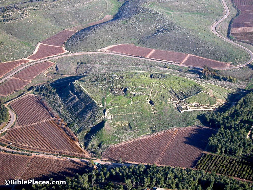
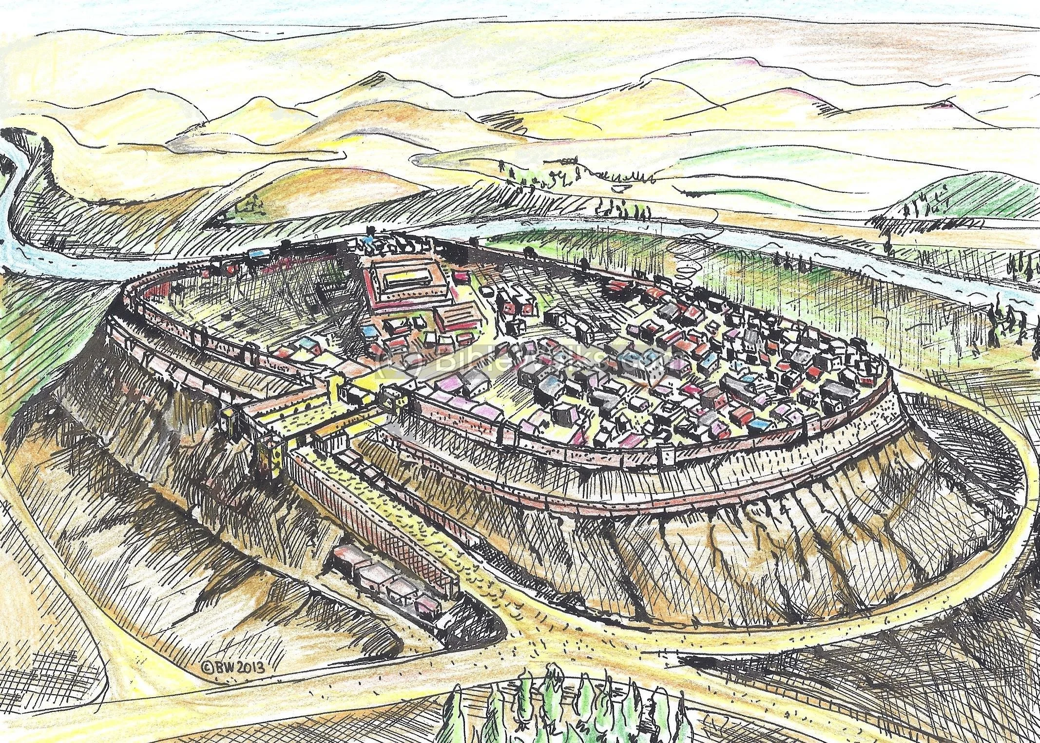
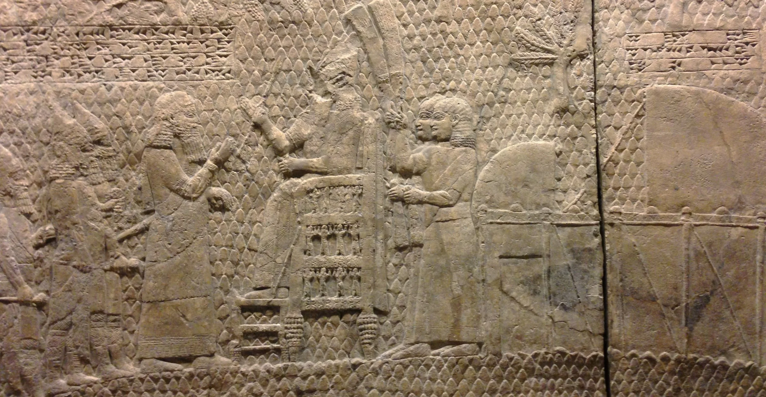
2 Chronicles 11:9 lists Lachish among the cities Rehoboam fortified. Lachish was strategically located in the Shephelah and later became one of Judah's major fortified cities.
The archaeological remains at Lachish demonstrate the importance of the site in later periods.
-
Shishak is the biblical name for the Egyptian pharaoh generally identified with Shoshenq I, founder of Egypt's 22nd Dynasty. The biblical books of Kings and Chronicles describe his campaign against Judah during Rehoboam's reign.
-
According to 1 Kings 14 and 2 Chronicles 12, Shishak's army reached Jerusalem during Rehoboam's fifth year. Rehoboam and the leaders of Judah submitted, and the Egyptian forces took treasures from the Temple and the royal palace.
-
Yes. There is an important Egyptian inscription at Karnak associated with Shoshenq I that records a military campaign during the period traditionally associated with Rehoboam.
The identification of the biblical Shishak with Egyptian Pharaoh Shoshenq I is widely accepted.
-
Jerusalem was Rehoboam's capital. David had established Jerusalem as the capital of Israel, Solomon had built the Temple there, and Rehoboam inherited the city as the capital of the smaller Kingdom of Judah after the northern tribes separated.
-
Yes. Rehoboam remained king in Jerusalem and continued the Davidic dynasty in Judah. The dynasty established by David therefore continued in the southern kingdom even after the northern tribes established an independent kingdom.
-
Rehoboam's reign marks the transition from the united monarchy associated with David and Solomon to the two-kingdom period of Israel and Judah.
His reign also established the political geography that would characterize much of the First Temple period: Israel in the north and Judah, centered on Jerusalem, in the south.
-
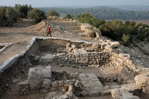
Several archaeological sites associated with the geography described in the biblical account can be visited today, including Jerusalem's City of David, Tel Lachish, Tel Azekah, Tel Socoh, Tel Ziph, and the area of ancient Shechem/Tel Balata.
The surviving remains belong to multiple periods, however, so individual structures should not automatically be identified as buildings constructed by Rehoboam.
-
David established Jerusalem as the capital of the united kingdom. Solomon expanded the kingdom and built the Temple. Rehoboam inherited that kingdom, but during his reign it divided into Israel and Judah. Jerusalem remained the capital of Judah and the seat of the Davidic dynasty.